Highland Heights Study

In early 2018, the Metro Planning Commission and Highland Heights neighbors asked the Planning Department to work on possible refinements to current land use policies in the Highland Heights area. Planners then refined maps and materials and created a draft plan document, based on community input received during a charrette week in March 2018.
Map of the Highland Heights study area
The Highland Heights Small Area Plan illustrates the neighborhood vision, taking into account competing interests and balanced with sound planning principles. The plan guides the appropriate land use, development character, and design intent established by balancing ideas and concerns among neighborhood stakeholders. The small area plan will be used as a starting point for discussing public and private investment, including zone changes, and public infrastructure investments.
Land use policy guides the Planning Commission's actions on zone changes. Any updates made to these policies do not change current zoning.
June 14 - Planning Commission approval
The Planning Commission approved the plan amendment by a 7-0 vote during the June 14, 2018 regular meeting. The approved study is linked below.
If you have additional questions or comments, please contact project leader Marty Sewell.
Public Hearing Draft
The draft plan, presented to the Planning Commission on June 14, outlined recommended policy changes and proposed Supplemental Policies, including a Building Regulating Plan, in addition to the guidance already found in the Community Character Policies.
The "errata sheet" pdf listed changes made from the previous draft.
- Highland Heights Study - the main policy document
- Highland Heights Charrette Report - appendix to the Study
- Errata Sheet - identifies minor edits included in the Study draft
Our goal is to ensure that policies affecting the Highland Heights area accurately reflect how the members of that community want growth and preservation to happen in the future, and that any significant changes are guided by community input and discussion. The East Nashville Community Plan describes how current land use policies are applied in the Highland Heights neighborhood.
Community Participation

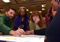
Metro planners held a series of public meetings and discussions, or "charrette," in early March, working with local property owners, residents, and business owners to get community input on any possible policy changes.
Numerous Highland Heights stakeholders (residents, property owners, business owners, development professionals, and elected officials) participated in the charrette week meetings and design process.
Stakeholders talked with the Community Design team about the issues the community faces and worked on design solutions. The Community Design team worked diligently to address neighborhood design issues promptly and generate land use policy and appropriate building type concepts.
Existing Conditions in Highland Heights
- Aerial photo of the neighborhood
- Zoning map
- Map of land use policies
- Map of Community Character policies
- Growth and Conservation Concept Map
Presentations and Other Materials
From the Monday visioning session:
From the Thursday draft presentation:
