Mountain Bike Trail Locations and Maps
Percy Warner
Eight miles of trails run through the northwest section of the park with a trailhead at the Percy Warner Park Golf Course and at the Deep Well park entrance. There are trails for all skill levels, ranging from beginning to advanced. Check the trailhead signs before you ride. Check for trail closure updates on our Twitter page. Please DO NOT park in the neighborhood around Cheekwood, at any of the picnic shelters at Deep Well, or on the side of the road. Contact Jon Dodson with questions, comments, or concerns at 615-642-9745. For information on volunteering to help maintain the trails, contact the Southern Off-Road Bicycle Association (SORBA)
Warner Park Mountain Bike Trail Map
Hamilton Creek
Hamilton Creek Park is located off Interstate 40E, past the airport going east. Take exit 219 at Stewart's Ferry Pike. Stewart's Ferry Pike turns into Bell Road. Follow Bell Road about three miles to the park entrance noted by a Metro Parks - US Army Corps of Engineers sign. Hamilton Creek is one of Metro Parks' four parks that contain mountain bike trails. With just a little over 11 miles of single-track, Hamilton Creek has enough limestone rock and exposed root to satisfy the most discerning of technical riders. Rated as an Intermediate/Advanced Trail system, Hamilton Creek offers two loops of varying difficulty. The Lakeside Trail (Intermediate - 4.5 miles) gives you numerous opportunities to practice your skills on technical single-track. The Pinnacle Trail (Advanced - 6.5 miles), flows at a faster pace and constantly challenges you.
Trail features include creek beds, narrow passages, multiple rock drops, log crossings, and steep downhill sections. Riders should expect fast, flowing sections of trail to break up the overall technical demands of these trails. Utilize the system in either a clockwise or counter-clockwise direction. Port-O-Let facilities and water are at the Lakeside trail head. Park at the Lakeside Trail (Hamilton Creek Park main). The Ned Shelton Road parking lot is closed. Volunteers from the Middle Tennessee chapter of SORBA maintain Hamilton Creek's trails. To contact the Middle Tennessee chapter of SORBA please visit there website at: http://sorbamidtn.org/
Hamilton Creek Mountain Bike Trail Map
Bells Bend
5.5 miles of trail at beginner to intermediate level Bells Bend trails are open and Metro Parks offers seasonal FREE mountain bike check-out at the Bells Bend Outdoor Center. Call ahead at 615-862-4187 or 615-642-9745 for availability and trail conditions.
Working in partnership with the Middle Tennessee chapter of SORBA, Bells Bend has 5.5 miles of single-track trails ideal for beginning riders, children, and families. The landscape will include small rock formations, some exposed roots, open fields, and rolling hills.
There are 5.5 miles rated at the beginner/intermediate level.Parts of the trail will offer a slower-paced, relaxed ride for cruisers and other parts will be more technical with a few switchbacks. The system will be utilized in either a clockwise or counter-clockwise direction. The trails will be closed in wet weather conditions. Port-O-Let facilities and water will be available at the trail head or visitors can utilize the restroom facilities at the Bells Bend Outdoor Center. For easy access to the trail system, parking will be available at either the trail head or at the Bells Bend Outdoor Center. The proposed trails will be maintained by volunteers from the Middle Tennessee chapter of SORBA.
Directions to Bells Bend Park and Outdoor Center:
From I-40E take exit #204 and go north on Briley Parkway. Take exit #24 and turn left onto State Rt. 12 toward Ashland City. Go over two miles and turn left at the stop light onto Old Hickory Blvd. Go four miles. The entrance to Bells Bend Park (trailhead) and Outdoor Center is on your right (two entrances).
Bells Bend Mountain Bike Trail Map
Cane Ridge
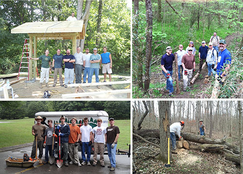
9 miles of beginning to intermediate-level trail winds its way through this awesome southeast Nashville park. The trail system at Cane Ridge will be built in three phases and will soon total nine miles. Members of the Middle Tennessee chapter of SORBA generously volunteer their time to build and maintain the trails. The park is located in Davidson County's southeastern border to the Rutherford county line, just off Battle Road. Over 80 volunteers from the Boy Scouts of America, United States Navy, Southern Off-Road Bicycle Association, and Tennessee State Trails and Greenways contributed close to 900 volunteer hours on the design, planning, and construction of the mountain bike trails at Cane Ridge.
Cane Ridge Mountain Bike Trail Map
Mountain Bike Trail Rules
- Motorized vehicles prohibited.
- Ride on designated trails only.
- Never ride on wet trails.
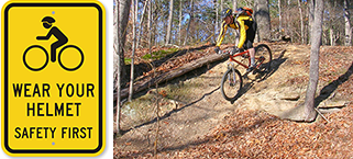
- Helmets required.
- Use trails at your own risk.
- Cell phones might not have service in some areas.
- Weapons and hunting prohibited.
For emergencies, contact the Park Police at 615-880-3429 or call 911.
For information about Mountain Biking in Metro Parks, call or text 615-642-9745.
Mountain Bike Trails
In 2011, Metro Parks and representatives from the mountain biking community – including Southern Off–Road Bicycle Association (SORBA) and the Mayor’s Pedestrian & Bicycle Advisory Committee – began working together to expand the system of mountain bike trails in Davidson County beyond the Hamilton Creek trails. New trails are now open in Percy Warner and Cane Ridge Parks. Trails at Bells Bend Park are currently under construction. For information about Mountain Biking in Metro Parks contact Jon Dodson at 615-642-9745.


